Tuesday 22 April 2014

Four day SOTA tour in the Middle Land G(M)4OBK with 2(M)0NON

Pendle Hill G/SP-005

On Sunday 13th April 2014 I was down to lead a group from Ryedale Walking Group (RWG) over Pendle Hill. As this meant I was part way to some unique Marilyn Summits in the Scottish Borders I decided to team up with Geoff 2E0NON and make a four day trip out of it....

As the Walks Coordinator and Webmaster for RWG I know it is always difficult to predict how many people will turn up for a walk. On Pendle Hill, a popular Lancashire summit (G/SP-005) seven people came forward including Geoff and another radio ham, Nick G4OOE who was heading for Wales after our walk to do some more activating there on the Monday and Tuesday. 

RWG at Barley setting out for Pendle Hill - Geoff, Owen, Jos, Jenni, Marcel and Phil (Nick G4OOE took the photo)
We took a route I last walked in 2005 via Ogden Clough then we left it to head up Boar Clough to reach the Beacon (or Big End) where the trig point is located. I reached the top after an 80 minute walk at 12.30 pm. Geoff and Nick went ahead once we reached Boar Clough and by the time I arrived they were already on VHF 2m FM making contacts for SOTA. 


After a lunch and the SOTA activation we walked off the hill to the west towards the top end of Ogden Clough to get a view of the Ribble Valley. From there we followed the edge of the hill round to the most popular route up and down. This is Pendle side which takes you on a steep stepped path down to Barley Lane.  A tour around Lower Black Moss Reservoir brought us back to the car park and cafe in Barley just after 3.00pm. 


Geoff and I said our farewells to the other members of the group as they headed for the cafe. With Geoff driving, our next stop was Penrith KFC for some food. Suitably refreshed we continued into Scotland to arrive at Grange Quarry, near Lockerbie. The quarry lies below Grange Fell (319m ASL). We were walking by 6.30 pm and on the summit in 25 minutes. 

Grange Fell GM/SS-249

As the quarry was closed we parked in the wide curtilage to the B7068 and climbed the steep bank at the back of the quarry offices. Then it was just a case of following the fence up to a firebreak (not shown on the map) which took us to a clearing on the top of the forest where the trig point is located. We had a light rain shower on the way up and another once we had set the gear up, so we settled for a quick activation on VHF (2m FM) remaining on the summit for just 30 minutes before we headed back down. In that time we completed contacts with seven stations, which included SOTA stations Paul GM4MD/P and Gerald GM4OIG/P who were on Cairnpapple Hill GM/SS-254 west of Edinburgh. The gear we used was a Yaesu FT-1500M running 40 watts to a home made dipole antenna set up about 10 feet off the ground on a fibreglass pole. Here is my station log - we both made contact with all seven stations. A GPX trace of the route we took can be downloaded from the SOTA Mapping Project by Rob DM1CM. 


Phil & Geoff at the rarely visited trig point on Grange Fell GM-SS-249


This is the parking spot used at the quarry gate, taken about 150 feet higher using the telephoto lens:


Grange Quarry - not working on a Sunday evening

With a successful activation completed we returned to the car and travelled very carefully up the heavily potholed road to Lockerbie and then on to Moffat via the M74.

Summary:
England
Pendle Hill Walk: 7.7 miles with 1450 feet ascent

Scotland Grange Fell: 1.6 miles with 500 feet ascent

Total: 9.3 miles 1950 feet ascent
Total QSOs: 7 on 2m FM
Summit to Summit Contacts: GM4OIG/P GM4MD/P GM/SS-254

Link to next day: Scaw'd Fell, Croft Head & Capel Fell

Monday 21 April 2014

Middle Land Tour: Scaw'd Fell - Croft Head - Capel Fell 14th April 2014

We were booked into the Best Western Moffat House Hotel on a room only basis for Sunday, Monday and Tuesday nights. With Pendle Hill and Grange Fell activated en-route on Sunday we arrived at 8.45pm. After freshening up I had a walk around the town and ventured into The Stag Hotel for a swift pint of Tennant's. Here I was able to engage with the friendly Scots locals and find out about the two places where we could get breakfast food and a packed lunch from 7.00 am every morning. 

Moffat House - our hotel for the stay which was arranged "room only" through booking.com 
For Monday I had planned a sixteen mile circular walk visiting the summits of Scaw'd Fell SS-142, Croft Head SS-100 and Capel Fell SS-082. The one snag was the long walk back to Geoff's car via the A708 Moffat to Selkirk Road, but that was shortest way back with lesser ascent than returning via the Southern Upland Way (SUW LDP), which we were using for the most part to reach the summits. I had looked at also visiting Ettrick Pen SS-074, but decided this was "a bridge too far" and decided to save that one for another day and go to it from the north instead. Here is our route which has been downloaded into the SOTA Mapping Project provided by DM1CM:


Scaw'd Fell GM/SS-142

Parking up and booting up at Belshaw Pool Bridge near Moffat
We left the car at the bridge at Belshaw Pool NT 106043 and walked along the graded SUW forestry track to where we turned right at 150043. We reached the summit of Scaw'd Fell after walking the 4.6 miles to reach it in 95 minutes.  

The writer on Scaw'd Fell SS-142
We used the substantial cairn to support the pole - we had just enough rope to get round the cairn twice. There is also a fence close by but we opted for the cairn due to the land falling away sharply to the south near it which would improve the signals. Geoff (chief knot tyer - former boy scout!) worked the 2m FM band and I got on with 40m CW, QRP style, with my recently purchased secondhand FT-817ND using the internal battery. It was immediately obvious when Roy G4SSH answered my CQ that I was going to have great enjoyment and fun using the little radio on the summits.... 

Between us on 2m FM (40 watts to a dipole) and 40m CW (5 watts to a dipole) we made 24 QSOs in 30 minutes of operation. I looked at using 40m SSB but the area around between 7110 and 7130 was wall to wall with continental stations which I deemed would be unproductive with the low power, so we pulled the plug and headed off to our next summit of Croft Head. 

At the information point in the middle of nowhere on the Southern Upland Way 
We rejoined the SUW. The LDP left the forestry track on to softer ground at an information point (158044 - OS map was slightly out). Beyond Crookedside Scienders we followed the fence up a precipitous slope to the summit of Croft Head. This proved to be a lung buster of a climb and we needed a rest part way up the slope:

We stopped for a drink on the steep ascent up to Croft Head
The walk from Scaw'd Fell was exactly three miles and it took us 93 minutes to do it.  Maybe taking the alternative route up Cat Shoulder, where we came down, would have been a wiser decision.... It was on Croft that we met our only other walker over the whole three days. A lone man who had wisely climbed to the summit via Cat Shoulder. We exchanged pleasantries and explained what SOTA was about when he asked the question as to what we were doing. He departed as his eyes glazed over....

We increased our QSO total for the trip on Croft Head by 32 more stations by using 40m SSB for the first time on this tour. In fact, more contacts were made on SSB from here than on CW, which is unusual. The earlier congestion around 7120 KHz had eased. With the low power from the FT817 on internal batteriesuse the best DX were contacts with four German stations - all the rest were UK. 

Geoff settles down for a rest and some operating on Croft Head

From arrival to departure on Croft Head took 52 minutes including eating, drinking, operating and jointly setting up and taking the station down. This day was the first we had operated on several summits using a combination of 2m FM and 40m CW/SSB operation and we found that roughly one hour spent on each summit was sufficient to work any operators that may have heard our signals. The ability to self spot was patchy - sometimes cellular access was available (Vodafone) but at other times, not so. Reliance on sending SSH on 7032 KHz usually brought a response from Roy if we had comms, otherwise CQ calls revealed chasers calling within a minute or two. When moving to SSB it was harder to attract attention without a self spot, however most often it was Mick M0MDA, also in Yorkshire, who found us first. 

The sheepfold alongside the SUW below Cat's Shoulder
Craigmichen Scar and Rae Grain  which lies below our final summit of the day Capel Fell SS-082
Capel Fell GM/SS-082

Our walk to Capel Fell was a steady one, again using the SUW which deviated from the map north of Park's Well on one section but as it was waymarked that way we took it and it was a good route. When we reached the fence at 171063, close to Ettrick Head, we looked up to Ettrick Pen SS-074. I would have loved to have gone for it, but the extra 5 miles and 1500 feet ascent would have been too much for us in the day. 

Geoff sets up the antenna on Capel Fell - another summit with a useful fence over it
It took 70 minutes transit time from Croft Head to Capel Fell and we reached the summit at 2.25pm. We had a longer stay on this one - 70 minutes, in which we made 28 contacts between us. We also eat and drank a fair bit too - knowing that we had a two hour walk back to Belshaw Pool of six miles. 

Addendum October 2019: If you read this blog with a view to activating Capel Fell on HF or 2m SSB please contact me via the email address in QRZ.COM to let me know, as I still need to chase the summit for SOTA Complete! 73 de Phil G4OBK

Coming down off Capel Fell - Top Broken Back, middle, looking towards Hart Fell SS-037 bottom, near the Fish Farm
We reached the car at 5.15pm after a 9 hour day on our feet and on our backsides operating for Summits On The Air. Our first stop was The Stag Inn at Moffat for a cooling pint of Tennant's before returning to our hotel next door to freshen up before going back to The Stag for our main meal and drinks. 

Distance walked: 15.8 miles
Total Ascent: 3740 feet
Total contacts: 84
Contacts on 2m FM: 30
Contacts on 40m CW: 29
Contacts on 40m SSB: 25

Summit to Summit Contacts:
GM0VWP/P 2m FM SS-171 Scotland
HB9BCB/P 40m CW GR-161 Switzerland
G0EVV/P 2m FM SP-008 England
GW4OOE/P 2m FM NW-053 Wales

Sunday 20 April 2014

Middle Land Tour: Well Hill - Ballencleuch Law - Hods Hill 15th April 2014

Tuesday 15th April 2014

We rose at 6.15 am and were in Little's Bakers and Confections in Moffat town centre by 7.00 am buying bacon baps, tea and packed lunches to take on the fells. Little's provide an excellent early morning service for workers and early starters.

Litlle's Shop in Moffat just down from our hotel
The plan for Tuesday was a day fellwalking further north and doing SOTA in the Lowther Hills (known as The Lowthers), which are part of the Southern Uplands. These hills rise to 732m ASL on Green Lowther (GM/SS-056).  Our three target fells today were located at the northern end of the Dalveen Pass, the A702 road which runs from Carronbridge on the A76 Dumfries to Kilmarnock road to the M74 at Elvanfoot. We also wanted to see if Green Lowther could be accessed by car via the private tarmac road to the NATS Radar Station from the B797 at Wanlockhead, if we had time. 

From Moffat it was a short drive to the parking place near a mobile phone mast just off the A702 at NS 926084. 

Well Hill GM/SS-112

2E0NON's Wagon parked just off the A702 for SS-122 & SS-075
We left the car and headed for the summit of Well Hill at 8.25 am, arriving on the top at 9.15 am. An old Roman Road goes to the village of Durisdeer, we followed it for 1 Km until we turned right to follow the moorland ridge along animal and quad tracks. It took us 50 minutes to reach the summit. 

Geoff coming up Well Hill - he was finding it hard work in the morning, I felt the same about the afternoon
Right click open new window for large view
Just like the previous days summits near Moffat, SS-112 Well Hill, has a fence running across the top providing us with the support for our 5m pole, link dipole and 2m vertical dipole. I concentrated on 40m and put 24 stations in the logbook in less than half an hour including Paul GM4MD/P on 2m, who was further north, on the summit of Black Mount SS-158. It was purely coincidence that Paul and Gerald G4OIG were in the same SOTA area as we were and workable on 2m FM. I only discovered they were travelling to Scotland the day before we set out. Geoff concentrated on 2m FM and made 8 QSOs including Jack GM4COX/P and Gerald GM4OIG/P who were also on Black Mount.  Top Northern Ireland Chaser Victor GI4ONL, was also logged on the 2m band. We spent less than an hour on the summit and then followed the fence SSE back down to the Roman Road which was crossed on our way to the top of Durisdeer Hill.

Ballencleuch Law SS-075

Scald Law was crossed next and by following the walls and fences we reached Ballencleuch Law SS-075 90 minutes after leaving Well Hill. The weather was fine and sunny. 

Looking back to Well Hill and down to the Roman Road as we ascend Durisdeer Hill
Geoff rigs our antenna on Ballencleuch Law GM/SS-075 - the highest we climbed on our tour at 689m ASL
55 minutes was spent on SS-075 and we made 36 contacts between us. Our first contact was with our best friend Nick G(W)4OOE/P who we had climbed Pendle Hill with two days previously. Nick was on Snowdon and we worked him on 2m FM over a distance of 157 miles / 253 Km. The mainly sea path must have helped. 

Line of sight path from Ballencleuch Law SS-075 (left) to Mount Snowdon NW-001 (right)
I was unsure of our most effective route back to the car but we took a punt by following the Gana Burn down to a sheepfold at NS 921060. I'd feared this would be boggy but this was not the case after a few weeks of dry weather - the route was excellent. I'd held off having my lunch regretting this later as I "blew up" with hunger knock as we neared the car and never recovered fully until we returned to Moffat at the end of the day after our third summit of Hods Hill SS-131. 

Hods Hill SS-131

Parking place near Daer Reservoir for Hods Hill GM/SS-131
After a late lunch back the car we drove to the entrance gate to the Daer Reservoir site at NS 972096. From here we tried to follow the Southern Upland Way and this proved difficult at times as the path was not so clear through the long dead grass. For a long distance route this section was obviously rarely walked and appears not to be maintained by the local authority compared with the section we had walked in the Dumfries & Galloway region. As I was feeling quite weak due to allowing my reserves to dwindle, Geoff went ahead and I trudged along reaching the summit in 55 minutes over a distance of 1.9 miles. To our left was the massive Lowther Hills Wind Farm, the largest I have seen:

Rigging our antenna on Hods Hill GM/SS-131
Hods Hill SS-131 has a double elongated top and we set ourselves down at the fence corner on the first high point reached. The SOTA activation zone is around 1 Km in length if you trace the 25m drop zone across the top of the hill.  I started to feel better once we sat down and started operating the radios. Again we remained on the summit for 55 minutes from arrival to departure making 36 QSOs between us on 40m CW/SSB and 2m FM. All three summits were qualified on 2m FM by Geoff running 40 watts from an FT-1500M, and my contacts on 40m were QRP using the FT-817.  We were back at the car at exactly 5.00 pm and on our way see if the tarmac road up to Green Lowther near Wanlockhead (GM/SS-056) was accessible by car. We had no energy left to contemplate climbing it on foot!

Green Lowther SS-056

We drove back to Elvanfoot and turned left on to the B7040 to Leadhills and Wanlockhead. We reached the gate to the radar station to find it locked - and locked it was, good and proper with ten high security padlocks! 


With no energy and time left to physically climb up Green Lowther (a round trip off almost 7 miles and 1300ft ascent) we turned round and headed for the Stag Hotel in Moffat for a pint of Tennant's and a meal. 

Distance walked SS-112-SS-075 & SS-131: 11.9 miles
Total Ascent: 3030 feet

Total contacts: 105
Contacts on 2m FM: 20
Contacts on 40m CW: 43
Contacts on 40m SSB: 42

Summit to Summit Contacts:

M0IML/P SE-015 to SS-112
GM4MD/P SS-158 to SS-112
GM4COX/P SS-158 to SS-112
GM4OIG/P SS-158 to SS-112
GW4OOE/P NW-001 to SS-075
M0IML/P SE-015 to SS-075
GM4MD/P SS-209 to SS-075
GM4OIG/P SS-209 to SS-075
GM0VWP/P SS-167 to SS-131
2E0YYY/P SP-007 to SS-131

Wednesday 16 April 2014

Middle Land Tour: Cairn Hill - Wauk Hill - Bogrie Hill - Fell Hill 16th April 2014

After our visit to the securely locked gate leading up to Green Lowther GM/SS-056 the previous evening, we decided to restructure our final day in Southern Scotland and attempt the activation of four one point summits on HF/VHF before returning to England.

Cairn Hill GM/SS-194 (2.75 miles return - 875 feet ascent)

Parking up near Kirkbride Farm for Cairn Hill (Grid ref NS 857052)
Click for large map view
We left Moffat at 7.30 am and used the A702 Dalveen Pass to reach the A76 at Enterkinfoot near to Cairn Hill SS-194.

We were parked up and setting out at 8.30am on the 35 minute walk to the top. 

The barking dogs and flying guinea fowl at Kirkbride farm were no problem, thanks to a fairly new cattle grid which had been installed at the gate entrance to the farm.  We passed the remains of an old church covered in ivy - there was little of the church remaining, but the cemetery was substantial and was obviously being maintained to some extent:


After leaving cultivated fields a short walk over the moor led us to the top which featured another fence, gate and large pile of stones where we could shelter from the wind. 

Geoff 2(M)0NON setting up the antenna on Cairn Hill SS-194
Between the two of us we made 33 QSOs. 40 watts from the FT-1500M on 2m FM produced a disappointing result, with two contacts into Cumbria with M0XSD and 2E0MIX. Using QRP power with my FT-817 on 40m CW and SSB made up the remaining quota. G4ASA/P and 2E0YYY/P were contacted for Summit to Summit QSOs with my own part of England, where I am the SOTA Area manager. They were active from G/TW-004 Bishop Wilton Wold. We left the hill 50 minutes after our arrival and used a slightly different track steeply downhill across a field, to reach the car in just 26 minutes. An 11 mile drive via Penpont took us to spot height 143 on the A702 road for our next walk to the summit of Wauk Hill GM/SS-241. 

Wauk Hill GM/SS-241 (2.3 miles return - 705 feet ascent)

A "wauk" to Wauk Hill SS-241 from spot height 143 in a layby off the A702
click map for a larger view
Groundworkers were on with repairing the potholes in the roads of Dumfries and Galloway and we parked behind one in his JCB at spot height 143. A brief conversation was necessary to explain what we were up to and I was surprised to find out that he was aware of the summit names of where we were visiting. We went through the gate to undertake a walk of (again) 35 minutes duration. This brought us to the trig point of Wauk Hill at 357m.  This is the highest point in the Keir Hills which overlook Nithsdale. If you go there I would suggest crossing the ladder stile at the intersection of walls (NX 8376 9097) to place yourself north of the wall when reaching the summit. 

Catterblog writer Phil about to leave Wauk Hill and head back to the car for the next summit
31 contacts were made from here, and this time Geoff qualified on the 2m band using FM working as far as the station of Colin G4UXH in Milnthorpe 80 miles away. After a swift 40m and 2m activation we left the summit 47 minutes after arriving there. Working together in the setting up and taking down of the antenna and radio equipment and the use of just one HF and one VHF band was proving to be an efficient way of covering the maximum number of summits in the day. The heifers in the field on our way back to the car did not prove a problem as we gave them a wide berth.  Next stop after some lunch was Bogrie Hill GM/SS-205.

Click for larger map
Bogrie Hill GM/SS-205 

(2.4 miles return - 660 feet ascent)

A nine mile drive took us down some narrow lanes to the parking place for Bogrie Hill SS-205 on the tarmac road which leads to the farmstead of Shillingland. A 2 Km walk had an ascent of less than 200m and I found this to be the most enjoyable climb of the day, picking our way along the quad tracks and animal tracks on what looked to be a well maintained piece of moorland.  We landed on the summit after a 31 minute climb and remained on the summit for just 53 minutes all told. We completed contacts with 30 stations, with 2m FM being easily qualified with seven QSOs. On 40m I had an almost even split of Phone and Morse contacts. 

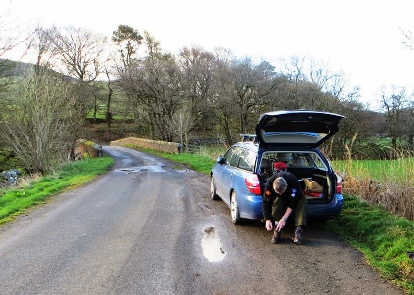
Parking by the roadside near Shillingland NX 783846:

Geoff  on the summit of Bogrie Hill - the forest shown on the 2014 OS map has now been felled...
Next stop.... Fell Hill GM/SS-217...

Fell Hill GM/SS-217 (4.15 miles return - 715 feet ascent)

A drive of less than four miles took us to the other side of Loch Urr and the parking place for Fell Hill GM/SS-217, a summit six miles north east of the village of Corsock.  After we already climbed three summits today and being on our fourth day activating for SOTA, we were both suffering a lack of energy, however we decided to give Fell Hill a try and so we set off from the car parked at Fell Bridge at 4.45pm:
A poor track leads to the ruined farm at Fell - NX 727846
Around the area of Bogrie Hill and Fell Hill we could see that the local authority had granted permission to an energy company to prospect for wind - there were three very high well guyed vertical masts containing telemetry equipment. If you are reading this a year or more later than when it is written (April 2014), you may find a wind farm here and improved access to this summit...


After 35 minutes walking we reach the ruined farm at Fell. We tried to calculate how long it was since it was occupied, a sad sight indeed. The track leading to Fell was extremely wet going through the pine woodland and before that in a few places, it had washed away completely meaning a short detour on to the moorland before returning to the better part of the track.  There was little ascent from the road up to Fell, and then the climb proper started. By this time we were pretty weak but the thought of a fourth activation in the day spurred us on to reach the obelisk like cairn on the summit, one hour after leaving the car, so we achieved an average speed of just over 2 mph - a reduction in speed on the usual progress we normally make on this type of one point summit. 

Our westerly track from Fell bridge to the top of Fell Hill GM/SS-217
Click for larger map
Catterblog writer Phil G(M)4OBK at the large cairn on Fell Hill GM/SS-217
With sufficient rope to hand Geoff trussed the 5m pole to the cairn. We made 23 contacts between us with 2m being easily qualified by Geoff - five England contacts and two in Scotland were made. We came and left after fifty minutes, reaching the car at 6.20pm, with Geoff facing the 175 mile drive back to my home at Pickering in North Yorkshire, before he returned to his home in Malvern the following day. 

We needed a quick meal after our day and where better for a swift bite to eat than the KFC just off the A75 in Dumfries? A party bucket and a large Cola each helped sustain us on our journey and we reached Pickering at 10.40 pm after a very successful tour in the Middle Land of Great Britain.

By the time Geoff reached to Malvern the next day he had driven well over 1000 miles on the tour. 

Statistics for the day:

Four summits climbed

Distance walked: 11.6 miles
Ascent: 2950 feet

Contacts on 2m: 19 
Contacts on 40m CW: 46
Contacts on 40m SSB: 51

Equipment:

5m pole inverted vee dipole for 40m, vertical dipole for 2m
Yaesu FT-1500M (40 watts from LiPO battery)
Yausu FT-817ND (5 watts from internal battery or 2 AH LiPO battery. 

Totals for the whole 4 day Middle Land Tour:

11 Activations in Southern Scotland

G(M)4OBK      237 Contacts (Mainly 40m CW/SSB)
2(M)0NON         84 Contacts (Mainly 2m FM)

Distance Walked: 41 miles (66 Km)
Total height gain: 10200 feet (3110 m)

As an activator and chaser the SOTA Complete Award is of greatest interest to me. This was created by the SOTA Management Team in 2013 after a great deal of thought and consultation with participants.

Here are the Top 10 standings in early May 2014 after my 11 unique Scottish activations, 10 of which counted towards my SOTA Complete score:


I'm keeping ahead of Tom M1EYP despite his recent spell in South Wales, but I have some way to go to catch Carolyn G6WRW up, who is 17 summits ahead of me...

73 de Phil G4OBK