Thursday 31 December 2015

A late December North Pennines SOTA Day

December 28th 2015 and my last chance to ensure that I came out as the highest scoring UK SOTA Activator, SOTA Chaser and SOTA Completist in 2015. Some radio amateurs say that SOTA - a specialised branch of the amateur radio hobby is not competitive. I think the opposite. In my opinion the league tables promoted by the SOTA Management Team, encourage healthy and competitive rivalry and this is what spurs us on to challenge ourselves to some demanding fellwalking and to visit places we would not go to if it wasn't for SOTA. The exercise in climbing to summits keeps one fit and healthy. SOTA is good for the body, good for the soul - but as many of us have found, it can become addictive and quite expensive due to all the travelling involved! However, the cheaper fuel prices, and low cost flights available with Easyjet, Jet2, Ryanair and others have helped this year in reducing our travel costs.  

To be sure I came out on top of the 2015 activator table I would need to garner as many points as possible in a single day. In past years my big winter bonus points gathering walk would be in the Lake District from Patterdale. It has been proved that in winter with the extra bonus points available it is possible to gather as many as 65 SOTA points in a single day (John Earnshaw G4YSS operating as GX0OOO/P in 2014):

A walk as tough as this in a single day in December would be beyond my capabilities in terms of daylight and stamina. The most I had achieved previously being 49 points was in February 2012. This was achieved by leaving out Blencathra and Great Mell Fell from John's list above. I had insufficient strength to do any more and I was four years younger then than I am today.... What turned me away from trying this round again this year was the terrible situation in Glenridding and Patterdale which was caused by the December 2015 floods, so I turned my attentions to the North Pennines area of North Yorkshire with a view to climbing as many summits as I could reach in the day. I was carrying a Yaesu FT-1500M 2m FM Mobile transceiver capable of 40 watts output. My battery was an Ultramax 7 AH LiFePo4, and my antenna was a home made half wave dipole mounted on a 57 cm long travel pole extended 5m above ground.  

Morning activations 

G/NP-010 Buckden Pike and G/NP-008 Great Whernside from the 500m ASL Cattle Grid at Tor Dike SD 986757. Points available: 18

First summit climbed Buckden Pike second summit climbed Great Whernside
I left my home in Pickering at 5.45am driving via Middleham through Coverdale. There was lots of standing water on the road and caution was needed with a reduction in speed in places to prevent aquaplaning. I reached the Tor Dike cattle grid at 7.30am and by 07.45am I was out of the car and on my way in the half light as the sun came up. This was the first time I had used this route up to Buckden Pike and I enjoyed it. The navigation was easy, following the walls and fence and it took less than an hour to reach the Memorial Cross where I set up behind the wall. 

Buckden Pike War Memorial
VHF Conditions were excellent and my first contact was with Gary M6GAD in Cromer followed by another with Andy M0TTB in Watford. I operated for 10 minutes on 2m FM completing 9 contacts before packing up when there were no more callers, returning to the car for some food and drink - one benefit from using this parking place in between the two summits which reduces the weight as there is no need to carry a lunchbox and flask! 

The walk from Tor Dike to Great Whernside I had done several times before. The climb is well used and is boggy in places but very straightforward. To save time I operated from the shelter rather than the trig point. This lies within the 25m activation drop zone and is 650m closer to the parking place than the trig point is.  
Shelter on Great Whernside - poor quality picture taken with mobile phone
I was getting out well from this location, which I hadn't tried before, as in the past I have always operated from the trig point. This  time from the shelter I completed 21 contacts at a rate on one per minute. Ascent time was 41 minutes, descent took just 25 minutes. 

Afternoon activations

G/NP-010 Pen-y-ghent from the Dale Head cattle grid at SD 843714 (424m ASL) and G/NP-017 Fountains Fell from the Blishmire Cattle Grid (425m ASL) at SD 853723. 
Points available: 14

GPX Tracks to NP-010 and NP-017 are available from the Viewranger and SOTA Mapping Project Websites
There is a metal postbox in the wall at Dale Head cattle grid for car parking donations - I posted my £1 coin. Once again this was a new route for me as previously I have climbed from the Pen-y-ghent cafe in Horton village, which normally takes me exactly one hour. This route is shorter and the walk up took me just 43 minutes. 
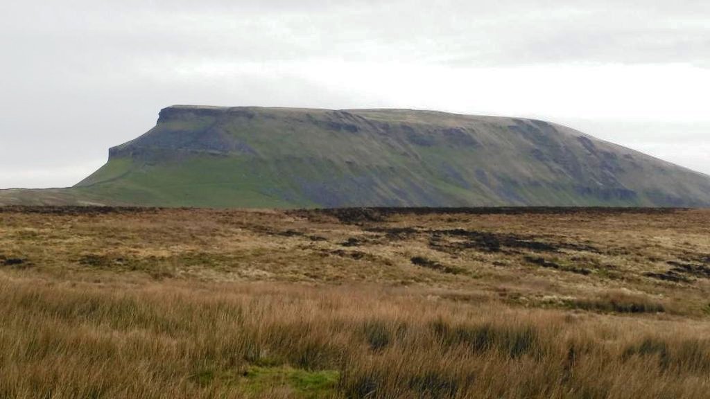
Pen-y-ghent on the day of my walk - weather dry perfect conditions for walking
Most of my time on the summit was spent chatting to walkers who were curious about what I was doing on the radio. I operated for 20 minutes in the end and made 24 contacts. The earlier enhanced propagation was no more, but the high contact rate with line of sight ground wave stations delighted me, as some amateurs on a recent thread on the SOTA Reflector were saying that 2m band contacts had declined compared to some years ago. 
My Berghaus 38+6 rucksack is packed and ready to leave Pen-y-ghent
I got back to my car at 3.10pm and moved it to the Blishmire Close cattle grid. I was walking again (wearily due to fatigue I have to say...) by 3.20pm and at the wall in the activation zone on Fountains Fell (SD 868720) at 3.54pm. There were fewer contacts from here as the take off on VHF is not so good. Out of the 13 contacts best DX was with my friend Dave from Pickering G3TQQ/M, who to be sure of a contact had driven up on to the top of the North York Moors near to the RAF Fylingdales radar site.

Fountain Fell wall stile from where I operated on 2m FM
It was quite dark when I left the summit and my headlight was deployed. I reached the car at 5.00pm, with 32 points earned, and 67 QSOs completed on 2m FM - a mode which is still very effective and popular for SOTA in Northern England. The 32 points meant I was now the highest scoring UK SOTA activator in 2015 by just 6 points, so the 7 points climb up Fountains Fell, despite the fatigue, was just enough to clinch the title of top UK Activator, Chaser and Completer in 2015

This was my final SOTA activation of 2015, which was a year when I travelled extensively pursuing my hobbies of amateur radio and hiking.  Countries with a SOTA Association where I visited in 2015 were England, Scotland, Wales, Belgium, France, Luxembourg, Netherlands, Mallorca, Italy, Czech Republic and Ibiza. I look forward to adding to this list in 2016.    

Day One - South & Mid Wales December 2015

I was in Bristol again in early December and arranged to spend 3 days activating SOTA in Wales with my friend Geoff 2E0NON who lives in Malvern. For the third time this year I spent £6.50 crossing the Severn Bridge for a SOTA Tour of Wales, meeting up with Geoff at the Flag & Castle B&B in Brecon at 7.45am on 8th December.

It was midweek and heavy showers were forecast all day. As usual Geoff was the driver and we made our way north to the Eppynt Army Ranges for our first activation of five summits I had earmarked for that day. This was to be a day with much driving and a little easy walking.
GW/SW-018 Mynydd Eppynt 

The well used B4519 road runs across the army ranges and we parked at the viewpoint, grid reference SN964466. I'd last been here in 1982 when I was taking part in a car rally and recalled cooking bacon on a primus stove on a cold and frosty morning at the viewpoint before the event started. After the 30 minute drive from Brecon we walked for a short distance down an asphalt track to the OP9 observation post marked on the OS map and set up inside the open doorway. We scraped by on 2m FM qualifying the activation with just 5 contacts - enough to tick this one off, enabling us to shut down and make our way to the next summit. 40 watts was used with an home made omni directional vertical dipole at 4m AGL. Not one I will revisit again I'm sure, but as a SOTA Completer and activator of "uniques" these days even the most of mundane summits need to be visited....

GM/MW-021 Crugiau Merched (English = Two Sisters)

We walked from Allt Goch, parking in a wide section on the C Class Road. We walked past the chapel and met the friendly lady at the cottage with such a beautiful garden there. She directed us to the gate to  left of her cottage which takes around the back and then on to a well defined quad track winding steeply up the hill on to the moorland. The chapel and cottage are seen here from above on the quad track:
This was a very pleasant and enjoyable walk to the two piles of stones on the summit (The two sisters). There had been a heavy shower before we started out and we were able to complete a dry activation with the minimum 4 stations logged to qualify the summit before departing.  
The writer at the trig point of Crugiau Merched
From MW-021 Geoff drove us south west to a parking place north of Llandeilo for our next summit. 

GW/MW-034 Mynydd Cynros

We walked up the shortest (but steepest) access route from the farm Cilyllynfawr, where we parked beside a large barn (pictured). A public right of way leads from SN 624335. Unfortunately one of the field boundaries had been fenced across, so we had to climb a barned wire fence. Other fence crossing points were either stiled or gated.  This obstruction was reported to Carmarthen County Council. A 30 minute climb took us into access land and directly to the trig point which had no centre in it. It was raining hard when we arrived so rather than operate at the trig we got behind an earth bank and used a golf umbrella to keep the rain off the transceiver and battery, and to some extent ourselves. This was another 4 contacts only activation - we didn't stay longer than necessary as this was only the third summit of five we had planned to visit in the day.
Open trig point mount on MW-034 Mynydd Cynros
Geoff packing up the compact 2m antenna at the end of our 4 contact VHF activation

GW/MW-036 Pen-crug-melyn

Continuing westwards towards Carmarthen we reached the parking place for MW-036. A walk up a track of less than 400m took us to the highest point. It was raining again and we did the same as we had done on MW-031, setting up behind an earth bank away from the trig point with the umbrella keeping the rain off the gear:
Under an angry sky we completed six contacts before leaving to drive to Brandy Hill - the other side of Carmarthen.

GW/MW-037 Brandy Hill "Drive on" summit

Avoiding a new road which Alan GW4VPX warned us about earlier in the day, we drove into the village of Llanddowror and turned right on to the C Class road which took us to a transmitter compound on Brandy Hill. The road runs across the top of the hill so we simply got out of the car and operated a few metres away from it against the gate of the secure compound. It was now pitch dark as you can see from this picture of Geoff 2W0NON/P operating on his knees by the gate, where we had five contacts each on VHF 2m FM.

After completing the fifth activation we were ready for some food and found a McDonalds outlet by the ring road in Carmarthen. We then drove back to Brecon to check into the Flag & Castle Guest House (recommended). After getting cleaned up we went out and had fish and chips before visiting a pub in the town.

Day Two - South Wales December 2015

We left our guest house, the Flag & Castle in Brecon after breakfast at 8.30am and drove west along the A40, turning south to join the A4067 to park in the layby at grid reference SN 871196. This was the nearest place to GW/SW-006. Day one of this short tour had been easy on the walking and hard on the driving (185 miles), so today we did the opposite staying more local to Brecon with a view to climbing two more substantial summits and one easy one, which would be tackled at dusk.
GW/SW-006 Fan Gyhirych

The initial climb from the layby was steep and then the moorland walking became easier. Due to the weather conditions we couldn't see much.... There was no path to speak of only sheep tracks until we came across a path on the final stretch leading to the eroded area around the trig point. 50 minutes up (slow going in mist and rain) and 30 minutes down.
Contacts made from SW-006 using FT-1500M on 145 MHz FM with  40 watts output to a dipole 4m AGL
The start point for SW-003 was only around 4 miles away so after our "elevenses" we made our way there. 

GW/SW-003 Fan Brycheniog


Despite the intermittent rain and mist our walk up Fan Brycheniog was a lot more interesting than Fan Gyhirych was. We parked up next to the River Tawe at SN 853203. Our first obstacle was to cross the river which Geoff 2E0NON managed to do in style both ways. Here he is on our way back across after completing the activation:

From the river the path can be clearly seen heading up past several waterfalls until the Llyn y Fan Fawr lake is reached (45 mins). Here we join the Beacons Way long distance path which is stepped in places and well maintained. 

Summit shelter on GW/SW-003
It took another 25 minutes to reach the shelter from the lake and in the shelter we were joined by four army guys in civilian walking clothes undertaking some sort of training exercise.  To be honest they had picked a vile weather day for it. We wouldn't have chosen it ourselves but having paid for our accommodation and fuel to get to this remote part of Wales we had no choice but to go for it or the money would have been wasted.... We stayed 30 minutes and were pleased with the 12 contacts on 2m FM which included a summit to summit with Mal GW6OVD on GW/MW-011 Foel Cwmcerwyn:
On our way down - car can just be seen. GW/SW-006 visited earlier is still under cloud cover
GW/SW-022 Trichrug
 

Looking for unique summits we hadn't visited before Trichrug was the only obvious remaining summit in the area. The road got progressively rougher as we approached a known parking area so we parked Geoff's car at SN 693221 in a gateway and walked the rest of the way. 


Darkness seemed to fall very quickly - there was a couple of easy fences to climb and we set up the station on the 415m high summit in twilight behind a wall for shelter from the wind:


We got the necessary contacts and set off back to our Brecon B&B... 

Day Three - South Wales December 2015

The weather on our final day in Brecon was atrocious. Not to be beaten by it though we checked out of the Flag & Castle Guest House in Brecon and made our way to the parking place (SO 056176) for GW/SW-004 Waun Rydd, the last of the bigger summits we needed to climb in South Wales. If this one could be conquered it would leave us with just three easier summits to visit and activate to complete our activations of all 41 South Walian hills. 

GW/SW-004 Waun Rydd

Click for bigger picture
We followed the road on the west side of Talybont reservoir up to a free car park at Blaen y glyn - grid reference SO 056176. From here we walked up the Beacons Way leaving the main path for 400m to reach the summit - a small pile of stones. The path was excellent and easy to follow - distance walked 2.6 miles in 84 minutes with an ascent of 1350 feet from the car park. The views would have been excellent from the ridge but with rain and mist we could see nothing. The umbrella I was carrying came in useful on the summit and we were able to keep the radio dry during the activation. 
Geoff 2E0NON crossing a river on the Beacons Way around half distance from the summit

We were putting out good signals from the summit, with 13 contacts made in 15 minutes before dismantling the station. My North Ridge Go Outdoors boots failed me for the first time in a year - I think the rain ran down my overtrousers and into them resulting in wet feet. The main damage though was to my recently purchased Memory Map Platinum TX4 GPS / Android Phone. I had the unit in the inside pocket of my Berghaus Mera Peak jacket not worrying about it as the unit is supposedly engineered to IP68 and Military 810H standard. When I turned on the GPS screen at the summit to see if it had tracked our progress it flashed up and then died. Later on that day in a warm environment of a cafe in Talybont this is how it looked:
To their credit Memory Map refunded the £464 the unit cost in full...  I won't be buying another! 

When we reached the car we decided that this was no longer a three summit day in such terrible weather so we made for the cafe in Talybont for some tea and cake:
We decided to save Mynydd Llangorse GW/SW-015 for another day.  Instead we took a look at it from the summit of GW/SW-023 Allt yr Esgair:
Mynydd Llangorse behind Geoff who is on SW-023 Allt yr Esgair
GW/SW-023 Allt yr Esgair
We parked at the Village Hall SO122257. It was less than a mile to the summit from there and the rain had now stopped. 
This was a nice place with stone seating set into the wall and good views all round. We weren't so sure how we would do on VHF but we made 7 contacts each in a short time before packing up. 
Flooding in the Usk Valley below the summit
Three days, ten SOTA summits activated and 67 contacts. We were happy with that considering the weather....

Friday 30 October 2015

SOTA on Formentera - EA6/FO-001 Torre Mola

I realised when we visited Ibiza Town earlier in the week that many ferries ply their trade each day taking tourists to the island of Formentera, which lies about 4 miles south of Ibiza island. The ferry price varies and seems to be based on the speed of the boat - the faster catamaran ferries (35 mins journey) charge more. We bought our tickets from the port on the day of travel. 
Single way tickets cost €14 each way on the fastest boat
Formentera is 12 miles long and has a population of around 10000 people. There is a hill rising to 202m at its southern end called Torre Mola, which qualifies for SOTA as EA6/IB-001. We spent a day travelling to the island first to the port in Ibiza by car, then by ferry to the Formentera port of La Savina. Free parking in Ibiza Town is plentiful within a short walking distance from the port. 
Top: Leaving Ibiza Town Middle: La Savina Port Formentera Bottom: Formentera taxi prices 
From the port in La Savina we used the cheap public bus service to reach the start point of our walk from the village of el Pilar de la Mola. The port at La Savina is a place just for the tourists. It comprised many car hire and moped and cycle hire outlets on the quays, with a few cafes and small hotels. People usually travel to the island for its beautiful sandy beaches where nude bathing is permitted - we were the only people to ever travel there to activate EA6/IB-001 for SOTA as Torre Mola had never been activated before....
Our four mile linear walk from el Pilar ended in the village of Calo de Sant Augusti where we hailed a taxi to return us back to the port as the bus timings were not appropriate for a return journey. 

The highest point of Torre Mola is located adjacent to a house, with the elevated trig point / bunker marked as "privado". There was little ascent to reach the summit via farm tracks which had been built to gain access to a few small farms and well cultivated fields:
G4OBK XYL Judy - on a mission....
After 40 minutes we reached the rather unspectacular summit and I set up my station by first securing the fishing pole to a post adjacent to a bunker / trig point:


I completed fifty contacts running QRP in 55 minutes. This was well above what I would have expected - all were made using CW, but once again cross mode was attempted after the earlier failure of my microphone. This was quite successful with more stations achieving crossmode contacts on CW/SSB: OH9XX - HB9BHW - G0VWP - G0RQL - OE7FMH - G0TDM and G4SSH. There were three summit to summit CW contacts, one being DX with CT9/DJ5AA/P (Al). AC1Z and K4DY were also worked.  I went QRT after 55 minutes and we continued our walk down to the village of Calo de Sant Augusti.  Once the main road was crossed a rocky footpath taking us down to sea level provided spectacular views of the island:
We had missed the last bus back to the port so we just started walking in the hope we could hail a taxi. Within 15 minutes one arrived to take us back to the port where we enjoyed some refreshments before embarking the boat back to Ibiza at around 5.00pm. 

SOTA Ibiza - nearby EA6/VE-001 Vedra

On our ferry journey I was able to photograph the uninhabited island summit of Es Vedrà EA6/VE-001 which is located 1.5 miles off the Ibiza Coast. The summit is 382m ASL on this small rocky island of legends. This rather hazy picture was taken with a 20X telephoto lens:
The island is pictured on the cover of the Mike Oldfield's Voyager album.  I am unable to say if this rugged summit could be climbed without ropes and mountain climbing experience.... Six summits in Ibiza remain unactivated plus this one making seven.

This trip to Formentera was my final activation on my week long QRP SOTA holiday DXpedition to Ibiza. Here are the final stats: 

Summits visited: EA6/IB = 5 EA6/FO = 1
Contacts made: 238
Summit to Summit contacts = 9
Equipment used: Yaesu FT-817 with 3.3 Amp LiPo backup battery, 5m fishing pole. link dipole for 30m, 20m and 17m, Palm Key with Pico Keyer