Friday 13 February 2015

England South East South Coast SOTA Tour Feb 2015 Day 1

I drove 270 miles from North Yorkshire to Leith Hill then visited:
G/SE-002 > G/SE-007 > G/SE-014 > G/SE-006
10th February 2015


At last an opportunity arose for me to complete the activation of all Marilyn SOTA Summits in England - 14 summits in 4 days. If I could do it I would be the first Radio Amateur to make contacts with all 176 summits from my home radio station and additionally make at least 4 contacts from all 176 summits themselves. 

This was going to be a solo expedition by choice and two weeks before I set out I needed to book my accommodation. Using the booking.com website I decided that hotels were simply too expensive in the south of the country compared to the north, so I joined the YHA and stayed for two nights with them in dormitory accommodation. For the third night I felt I would push the boat out - so I stayed in a comfortable hotel in Swanage that night. My final fourth night would be spent at a relatives house in Bristol, before returning home to North Yorkshire. 

All fourteen summits were easy to access - but could I get around all of them in four days? I thought I could... A few days before I set out I started suffering with a bad cough and cold and felt quite unwell, however with the accommodation booked ahead I had to continue...

My modus operandi was to operate on the HF bands - mainly 30m and 20m in CW and SSB which would save me time. I was only to use 40m on my last summit on the Friday.

Equipment used:

Yaesu FT-817 Transceiver running 5 watts output from 3.3 AH LiPo battery on 13 summits with home made link dipole for 30m-20m-17m on 5m pole

Yaesu FT-857 Transceiver running 50 watts output from 5 AH LiFePO battery on G/SC-009 only with home made link dipole for 40m-30m-20m on 6m pole (Day 4 on SC-009 only)

Palm Paddle Morse Key - standard Yaesu Microphone

G/SE-002 Leith Hill QRV 1221z

An early 6.00 am start for my 270 mile drive south of London from North Yorkshire, was the only way I could complete my planned four SOTA activations in the day. 

On arrival at the car park for Leith Hill (TQ 130432) I ate an early lunch before walking to the tower on the summit, which is overseen by The National Trust. MY first contact was with Roy G4SSH at 1221z on the 30m band. 
Leith Hill tower which tops SE-002 
I set up my station well away from the tower to avoid the interest of any wardens. A well placed picnic table was most suitable for my short 20 minute CW operation on the 30m and 20m bands...


With 27 stations logged I packed up. No one approached me during the activation. 

G/SE-007 Crowborough QRV 1434z

Previous reports from activators her told of operating in a town, and t his is what it looks like on a map. There is a town on the summit. There is also Crowborough Beacon  Golf Club and I focussed my plan on parking there and finding a suitable place nearby to set up my station.

Parking at Crowborough Golf Club - 150m from where I set up my portable station on SE-007
242m is the highest point at the trig and I operated in the wood behind the golf club car park which was just above the 225m contour and almost 1 Km south of the trig point but still within the General Rules:

Parking TQ 5074 2984 Operating point TQ 5078 2991
To reach the wood I walked up the road for 200m and turned left on the public footpath before moving into the wood. The 30m band was very productive but 20m was not. I stayed with CW throughout to complete 24 contacts - only 2 of which were on 20m. I shut down at 1452z and opened up on the next summit, Cliffe Hill at 1610z. 
f
Operating CW on Crowborough
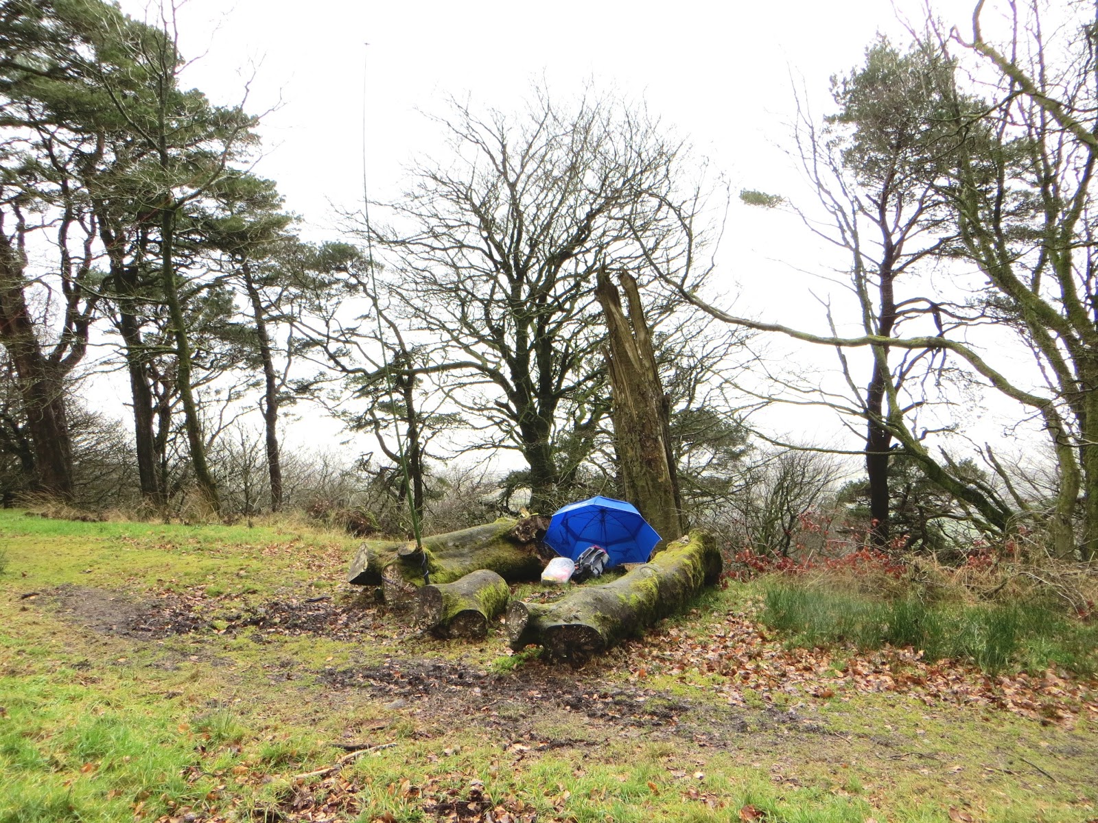
G/SE-014 Cliffe Hill QRV 1610z


The summit lies on Lewes Golf Course. A public right of way passes nearby. Fortunately I chose a time when all the golfers were at the 19th hole, as I arrived at the 9th hole at 1600z just as the daylight was starting to go... I drove up Week Lane as it is shown on the 1:25K map and parked in a wide section at TQ 448107. From there it took 20 minutes to walk to the summit. 

Nearby trig point (top pic) and operating position (bottom pic)
HF band conditions were poor now compared to around lunchtime. On 30m and 20m CW I struggled to make myself heard and made just 10 QSOs in CW before I packed up and headed west to SE-006 Ditchling Beacon. 

G/SE-006 Ditchling Beacon

A road passes through the activation zone and there is a car park on the summit. It was dark when I arrived and I walked as far as a gate and fence to which I fastened my fishing pole. A bitter wind with spots of rain in it was blowing. I was tired and I'd had enough by now, the cough and cold I had didn't help - it had been a long day. To move progress I made five quick QSOs on 30m in five minutes with OH9XX, DL6MST, HA5TI, S52CU and EA2DT. These were all callsigns I recognised as regular SOTA Chasers.  

YHA South Downs near Southease the following morning before I left - a 5 star Youth Hostel 
Feeling like death warmed up I drove through Lewes to the Youth Hostel at Itford Farm, Southease. Fortunately I secured a bottom bunk in a six man dormitory, prior to microwaving my evening meal, which I had brought with me, having established when planning my tour that there wasn't a pub nearby where I could get a meal.  I turned in at 10.00pm feeling slightly better after my meal...

Thursday 12 February 2015

England South East South Coast SOTA Tour Feb 2015 Day 2

G/SE-010 > G/SE-011 > G/SE-009 > G/SE-003
11th February 2015

G/SE-010 Firle Beacon QRV 0910z

Firle Beacon is one of the SE SOTA Summits that lie on the South Downs Way, which is a 100 mile long National Trail. The bridleway here is used by people exercising their horses at speed, and two came towards me on the bridleway:


I parked at TQ 4677 0586 and walked to TQ 4823 0594 where I set up my station by a gate, 300m from the trig point and 12m below it in height.  Roy G4SSH was waiting for me and gave me my first contact on 30m CW. Conditions were better on that band than on 20m, where only 3 stations were worked on CW. SSB was tried to no avail, no one came back to CQ calls despite a self spot, done using the Rucksack Radio Tool App. 31 QSOs in 28 minutes - I was quite happy with that using QRP, so I packed up and returned to my car. 


This old Crossville service bus had been converted into a "camper van" of sorts and was parked up with the curtains closed at the parking place for Firle Beacon. Whoever owns it obviously has an alternative lifestyle than most of us!

G/SE-011 Wilmington Hill QRV 1111z

Once again this summit lies on the South Downs Way National Trail. I parked at TQ 5318 0322 on a designated (albeit rough surface) car park. A rising track goes over the escarpment and I left the main trail at TQ 5403 0345 to walk a further 1 Km to reach the trig point. 

G4OBK/P operation on Wilmington Hill - camera was sat on the trig point on a timer
Ken GM0AXY beat Roy G4SSH into my 30m log on this summit. When I moved to 20m I tried some phone and worked Mike G6TUH and four more on that mode. Total contacts 29 in less than half an hour...

G/SE-009 Chanctonbury Ring QRV 1412z

Completely unfamiliar with this area I bypassed Brighton and several other towns using the A27 until I arrived in Worthing, where I stocked up at a Sainsburys supermarket on Lemsips, Coca Cola and fruit. From there I went north on the A24 beyond Findon. I parked on the western side of the dual carriageway up a side road. Once safely across the busy road I again used the South Downs Way to access the summit. At this point I was thinking this would be a great SOTA Tour to do on a mountain bike...food for thought, but not for me now as once a summit has been visited I am unlikely to return due to my hunger for visiting unique summits. This is something which has happened since I reached Mountain Goat status when I was in Ireland in January 2013.

Route taken - note the short cut on the bridleway on my return to the car
It was a 30 minute walk up and 24 minute walk down. A marker post for the path served as a support for my pole. Walking back near the trig point I came across this lovely sign on a gate telling me that the site was a SSSI: 

26 contacts on CW and no takers on SSB. Not being able to self spot did not help. I had no network coverage. Chanctonbury Ring was my favourite summit of the day, with far reaching views to the north especially. 

SE-003 Blackdown QRV 1635z

An activation started at dusk and finished in the dark, but most enjoyable it was with good conditions, the ability to self spot and much more success on 20m SSB. I parked in the designated car park near this sign at SU 933306:

Track leading to Blackdown G/SE-003
The sign struck me as odd - radar keys are issued to elderly and disabled people who may need access to public toilets when they are out of hours and locked.... There were no public toilets within Blackdown Woods as far as I could tell. I left the path and operated within a few feet of the highest point at SU 9204 2950.

Selfie of my left boot, station and rucksack on Blackdown
At 1702z I went QRT elated with the band conditions which allowed me to make 38 contacts in less than 30 minutes. 

I now had to drive a considerable distance to my accommodation at the YHA in Littlehampton, where I drew the short straw of a top bunk in six man dormitory room. The hostel was well located though, with a Weatherspoons pub around the corner with cheap food, drink and free wifi, so you can guess where I spent the rest of the evening. 

The YHA in Littlehampton - right on the quayside:


Wednesday 11 February 2015

England South East South Coast SOTA Tour Feb 2015 Day 3

G/SE-004 > G/SC-008 > G/SC-013 > G/SC-012
12th February 2015


SE-004 Butser Hill

Littlehampton Youth Hostel - where I spent an uncomfortable night - see below
I left Littlehampton Youth Hostel just before 8.00am. And where were the Youths?  I spied none over the two nights I spent in hostels, the age range being 25 to 60+ seniors! I had a restless night on the top bunk of a 6 bedded dormitory at Littlehampton, I put this down to a bad cough, flatulence and drinking a full bottle of red wine and a pint of lager at the Wetherspoon’s pub round the corner from the hostel....a little pre-emptive celebration I suggest for SOTA Completing the G/SE block of summits which I hoped would happen the next day on Butser Hill... I would then move on to complete the G/SC block and all 176 English summits would be SOTA Complete.

The proximity of the Littlehampton YHA on the harbour serving the town allowed me to grab some early morning breakfast food and a lovely “coffee to go” at 7.30am from a Morrison’s convenience store around the corner, as well as sandwiches and soft drinks for my day ahead. As I was solo this SOTA Tour of the South Coast was on a tight budget in regard to accommodation, hence my detour south to Littlehampton taking advantage of cheap dormitory rates for single travellers. Gone are the days when you were not allowed to stay in a Youth Hostel if you arrived by car. Hampshire is no place for a single person to find good value accommodation, where hotels can get away with charging London prices.

Today’s four summits involved a lot of driving. Thank you to my navigators, Mr Tom Tom and Mr Android Osmand+ for making it so easy. Garbage in = Garbage out though, but today it was Quality in = Quality out for 95% of the time. The bad 5% was no fault of my “navigators”, but was due to a road closure on the Isle of Purbeck, near Swanage.

It was quite a drive up and across country into deepest Hampshire to reach SE-004 Butser Hill though, on to land owned by the National Trust. This is a popular place for folk going out for a walk with their dogs to drive to. The summit is 20 Km north of Portsmouth and is just 1 Km west of the A3. You have to make quite a detour to reach the summit car park from the A3 itself, but the lanes are good and well used by visitors.

Activation spot on Butser Hill - below top well within 25m drop zone
The car park is inside the activation zone, and I walked through a gate for about 300m to set up (as usual when I can) by a fence which provided a support for my pole. My 25 minute activation started on 30m CW at 0930z and ended on 20m SSB at 0955z with 31 QRP contacts logged.  I drove west for almost two hours from there into Wiltshire to reach SC-008 Win Green. The SE summits are all very easy to access when compared to other summits in England and it isn’t difficult to successfully activate four or five of them in a day.

SC-008 Win Green

This was another easy summit involving minimum effort. The hill is 7 Km east of Shaftesbury. A short section of straight unsurfaced road takes you to the car park marked on the OS Map at grid reference ST 923204. This car park is again in the activation zone making the summit ideal for a night time sortie, however I arrived at midday and walked 300m over to the circular copse by the trig point. Round to the left of the copse was a wooden seat, a perfect place to set up the station.
G4OBK/P Operation from Win Green at the useful wooden seat by the copse on the summit
Conditions were the worst so far and I struggled to find contacts. I drew a blank on 30m CW and on 20m SSB despite self spots. I finished up calling CW on 20m CW making just 11 QSOs, with two being summit to summit.

SC-013 Nine Barrow Down

Less than two hours after going QRT from Win Green I was logging stations on Nine Barrow Down. This long escarpment lies just 3 Km north of Swanage where I was to spend the night in the luxury of a decent  hotel after two nights roughing it with the YHA....

Top of Nine Barrow Down where I set up my SOTA Station
The summit on Nine Barrow Down is on private land, and I operated from the top, near the radio masts, meeting the landowner in the process. He was a friendly sort and we chatted, he commenting that some years ago more amateurs used to visit, including some who took part in a contests. I could see why. This would be an excellent location to place a big VHF/UHF signal into mainland Europe. For me though, it was HF QRP and once again I opened up on the 30m band and finished on 20m SSB. How conditions had improved in just two hours since I had left Win Green. That’s Short Wave HF for you, and 40 chaser stations were logged in 30 minutes thanks to self spots and spots from friends such as Roy G4SSH of Scarborough, who was logged on 30m CW just after my first QSO with stalwart John, G0TDM of Penrith. I had once again resisted carrying the heavier FT-857 and battery, which I was reserving for my final English Summit next day. So I stuck with the 5 watts QRP from my trusty FT-817, a superb performer - you don’t need anything more for SOTA, and you can get by with a lot less, which my friends such as M1BUU, G4ISJ and OK2PDT (and others) have shown us many times with their QRPp homemade transceivers.

After the chat with my new friend the unnamed landowner, who said “next time you are passing call in at the farm for a cuppa” he gave me a lift back to the bridleway on his 2 seater all terrain vehicle with cab, and dropped me off from where I made my way back to the parking place used, which was on the B road at SZ 008818. Time for one more summit then before heading to my hotel in Swanage. I set off for SC-012 Swyre Head.

SC-012 Swyre Head

A few months after my activation of Swyre Head the RHoB Group announced that after a detailed survey the summit would lose its Marilyn Status. The survey group determined that Swyre Head lacked the necessary 150m prominence in all directions despite it being 203m high. The SOTA Management Team will no doubt announce its deletion very soon. This is a shame as the summit is reached by a very pleasant and it seemed on the day, popular walk, with great views.

Admiring the view on the walk to Swyre Head
I set up my station near a gate in a wall at SY 933736 after walking from the parking area marked on the map at SY 943792. I only operated for 20 minutes using my favourite mode of CW on the 30m and 20m. bands. By the time I returned to my car it was going dark. I headed into Swanage to my hotel.

Tuesday 10 February 2015

England South East South Coast SOTA Tour Feb 2015 Day 4

G/SC-011 > G/SC-009
13th February 2015

SC-011 Hardown Hill

I looked out of the hotel bedroom window above me at Nine Barrow Down (visited the previous day) and saw what the weather forecast predicted - heavy rain...

The hotel breakfast was superb. I was in no hurry today though as I left the car park at 8.45 am with just two summits planned and an overnight stay in Bristol, before driving home to North Yorkshire the next day. A long drive in rain from Swanage took me to the ribbon village of Morecombelake, which lies below Hardown Hill in Dorset. I decided to wait until the rain abated, and it did, but it started again as soon as my gear was taken out of the rucksack on the summit...

Rain is starting again as I reach the activation zone on Hardown Hill
Parking was quite difficult on the village road but I got into the side of the road at SY 406947 and walked south west up the narrow hedged in track on the left. The path was clear but I thought that if it wasn't cleared in summer as it was so narrow it would be covered with brambles then. Once near the top I made for the antenna mast and transmitter building where I hoped there would be some shelter from the rain which was starting again... 

I headed for the BT owned radio mast and building on Hardown Hill for some shelter
G4OBK/P operating position in the rain on Hardown Hill SC-011 in Dorset - be careful where you sit if you go there
It wasn't too nice where I sat... dog walking country this, I'll say no more. I quickly made sufficient QSOs - just 10 contacts in 5 minutes on the 30m band before I packed up quickly to save damage to the radio. My golf umbrella was forgotten and left in the car...


At least my brolly stayed blue - it would have probably been brown had I used it there (note comment above...). I carried my brolly though for my final activation of all English Summits on Lewesdon Hill later that day.

SC-009 Lewesdon Hill


Still in Dorset I arrived at the nearest road to the National Trust owned Lewesdon Hill from the south - via the B3162. Previous activators had sought permission to park in Stoke Knapp Farm. I drove around the triangle of roads around the farm. There was nowhere safe to park on the roadside without blocking the road or a gateway. I'm always reluctant to ask permission by knocking on doors and there was no one around the farmyard to ask. To save a longer walk from Broadwindsor the village to the north, I settled on parking just on the side of the B3162 road at SY 441016:


The rain had stopped but I carried my brolly - it came in later, as I set off on the short walk to the woodland above me marking the summit.  I left the road at Stoke Knapp heading up the track shown on the map as Lewesdon Hill Lane. My last English Marilyn Summit was a good choice. I discovered a 300m long medium width clearing in a Beech Wood. That was the summit.  I settled down my higher powered station for a long stay amongst some large fallen tree boughs. I had carried my Yaesu FT-857 for the first time use on this tour and I used a 40m link dipole to try to a least double the QSO total normally made on previous summits. I had no time constraints so it was a case of working down each band I had on CW and SSB until there was no one else there to work. 115 contacts were completed on the 40m, 30m and 20m bands. 


After 90 minutes in rain, I was still dry under the brolly apart from my overtrousered legs. I packed up and did a little dance to celebrate that I was the first operator to SOTA Complete all current 176 Marilyn Summits, a task which had taken me almost ten years. Writing this several months later no other SOTA Chaser - Activator has yet achieved this. When they do I will buy them a drink! I count myself first as a Chaser, as I spend more time doing that than I do as an Activator. Chasing is great, and once you have the gear it is cheap and convenient. Activating is not, it is expensive, time consuming, has a tough steep learning curve where mistakes will be made if real success is sought. It is also uncomfortable at times and very challenging and adventurous but it keeps you very fit if it can be done regularly. Combine all this with a love of driving, travelling and walking in the country and this makes SOTA activating a great part of my life long hobby of amateur radio. 

Elated, I drove up to Bristol, stopping at a fast food spot on a roundabout somewhere near Chard. The following day after my 14 summit solo odyssey I finished up back home in North Yorkshire.

This had been a testing tour, mainly due to me being under the weather whilst spending two nights in Youth Hostel Dormitories near Lewes and in Littlehampton before a comfortable third night in a decent hotel in Swanage. I'd driven 750 miles through tens of English Counties and once again confirmed to myself how much better life is in the north of the country. 

Which was the most beautiful summit? Lewesdon Hill in the rain of course! 

Monday 9 February 2015

Walking and Activating SOTA near Loch Lomond - February 2015

With my two friends Geoff Fielding 2E0NON and Dave Bottomley G3TQQ I have just enjoyed three good days walking near Arrochar in the Loch Lomond and Trossachs National Park, Scotland. 

I booked our holiday through the Scottish firm Lochs & Glens Coach Holidays. For around the cost of the fuel to get there and travel about in a 4X4 vehicle we were transported in luxury and had 4 nights half board in a hotel of a satisfactory standard... These winter coach holidays are so cheap for folk living up north. Lochs & Glens and Shearings make their money over the bar in the hotel, that must be why they do the holidays for such a cheap price...

One of the 30 strong fleet of coaches run by Lochs & Glens
Lochs & Glens own 7 hotels in Scotland and around 30 luxury coaches. Our party (of mostly retired folk) was picked up from six locations in North Yorkshire on Monday, and we returned home on Friday. We got on the coach in York and we have to thank Terry G0VWP for taking us to meet the coach with our bags. When we reached the hotel we found another two coachloads of folk were also spending a holiday there, the hotel was quite full.

On Day One we activated SS-218 Cruach Tairbeirt, a small hill to the rear of the Loch Long Hotel where we were staying.


Our ascent and descent was impeded by fallen trees, such as this one above but we found our way around them. One of the trees was useful though - this self seeded tree in the activation zone supported my antenna pole:


On Day Two of Three we were in need of transport to take us up Glen Douglas. This would allow us to complete a linear walk back to our hotel via two summits. There are no taxis in the area at all, so we found our man, who was called Ofer - he was the Entertainments Manager (He called the bingo numbers one night!) and we made Ofer an offer he couldn't refuse. £20 to take us the 10 miles to Glen Douglas at 8.45am the next morning - and he obliged.

Very patchy snow on the ascent of SS-081 Beinn Bhreac:


We were walking from NS 309987 by 0915z and on the summit of Beinn Bhreac GM/SS-081 (681m) by 1100z. I don't know about Geoff and Dave, who were using my gear but I made 35 QSOs around Europe on 40m CW/SSB.

As we we were about to depart SS-081 a couple of walkers turned up and kindly took our photo. Nick G4OOE referred to us as "The Three Amigo's" in an e-mail that night, and that made us laugh...


We headed downhill to a frozen depression and then ascended around 100m again to a col shown on the map as An t-Sreang at NN 302015 (359m). From there we turned left and tracked our way around wind slab snow and softer drifts to make our way to the top of the 2nd summit which was SS-103 Tullich Hill (632m). We just did it without needing to don our crampons...it was a close run thing.

This is a picture of the pointed north easterly flank of Tulloch Hill SS-103 which I captured from SS-218 the previous day:


Picture below shows recent Septuagenarian Geoff 2(M)0NON front and Dave G(M)3TQQ (who is not far off being one) behind, climbing to reach the top of Tulloch Hill SS-103. 


We were cold and miserable sat on a drift out of the wind on Tulloch Hill, thankful for the 25m height rule but we didn't want to linger for long. I was happy just to take 13 quick CW QSOs and 2 in SSB on 40m in 15 minutes before passing the microphone to Dave and Geoff to finish until the stations calling dried up. and allow us to get back down before dark. 


HF SOTA operation on Tulloch Hill GM/SS-103 - glad I was wearing thermal long johns and my lined Paramo Walking Trousers!
We left the top at 1445z and were in Ben Arthur's Bothy Bar in Arrochar for much needed food and drink at 1730z. This had been a satisfying day, which added up to an 8 mile walk with 3400 feet of ascent on difficult ground for 10 SOTA points apiece.

It became apparent during the activations that my FT-857 appeared to need attention. On SSB it was reported the TX was drifting and apparently I was working split to some extent by hundreds of hertz with distorted audio.... we thought it may have been low battery voltage but that was not the case... tests needed when we get home but it looks like the radio will have to go down to Yaesu for a refurb....these radio's aren't meant to take the abuse they suffer in a rucksack on the hills...the radio has had a hard life. 

Day Three - SS-090 Beinn Dubh

Our driver "Don't call me driver, my name is Michael" was taking our tour bus to a museum and Glasgow City centre on day three, so I approached Michael to see if he could oblige us by dropping us off in Luss. He said he could, and not only that he could collect us on the way back if we were waiting in Luss at around 4.30pm.

These coach tours are so regimented, almost like a military exercise in all respects, including meal times at the hotel, and the posting of notices on a board to clearly explain the day to day arrangements. It all runs like a well oiled machine...

Once on the coach there was much laughter from the other guests, when someone shouted "Have you got your crampons?"

From the car park in Luss village we crossed the main A82, (the road beside Loch Lomond) via the footbridge, to join the well used path (as it turned out) up to SS-090 Beinn Dubh (657m for 2+3 WB points and a Complete for me). My friend Iain MM3WJZ had given me some guidance on this summit - not to be caught out (thanks Iain). The summit marked on the map as Beinn Dubh is 642m high. The actual summit however is across a long plateau 2 Km to the north west. It is unmarked and is 657m high. In between there is a depression in the path which falls to 595m. In a straight line path from the marked summit to the actual top though the land falls to less than 500m. The hillbagging.co.uk website make it a little more understandable - they call the summit Mid Hill (Beinn Dubh). Mid Hill is the closest named high point to the actual top on the OS 25K map.

We had the most beautiful day for our walk, full sun most of the time and no wind. Here is Dave G3TQQ coming up, with Loch Lomond and all its Islands as a backdrop:


Dave started activating SOTA this winter and lives close to me in Pickering. He's got the SOTA Fever now, and there is at least one other ham in the area where I live also who is becoming addicted....

There were plenty of folk about,even though it was mid week and not school holidays - it was very safe with just a few patches of snow to cross on our way to the top. The walkers we encountered were all local Scots, and friendly too, stopping for a chat as you can see in this picture:


Back in Luss we called in for refreshments at the Village Rest Cafe and Bistro which stays open until 4.00pm in winter. One of us downed two pints of draught Guinness... the other two had a pot of tea and Caramel and Apple Pie with Cream each...delicious!