Leaving Masary Chata at 10.30am local time I set off on the gravel tracks of the Eagle Mountains. The 25 kilometre long ridge marks the border between the Czech Republic and Poland. On this ridge there are 14 summits listed for Summits On The Air (SOTA) and I planned to climb and activate each one over three days.

A gravel track took me to a hotel at Serlissky Myln from where I climbed a woodland path to join another gravel track, which was a popular cycling route. I reached a bunker and then turned left to walk through woodland right on to the summit of Kamenny vrch, KR-064.
 |
| The first bunker seen of the many I passed on my tour |
Using an FT-817 and dipole on the 30m and 20m bands I made plenty of contacts around Europe, before heading off to activate Sedlonovský vrch, KR-061. As I was walking an old tractor came towards me on the track. I got a funny look from the tractor driver - presumably this was because I was taking a photo of a Czech tractor....

Soon after this I struck out and went through the wood on my right to the summit of KR-061, which was again in woodland, as most summits in this range are, despite almost all of them being 1000m above sea level. Continuing on my way after activating KR-061 I jumped down a bank to rejoin the track, and fell over ripping the left knee on my walking trousers! A slight graze was all that resulted, and I continued on my way to Polomský kopec KR-068, the summit of which was actually on the track. In this popular area for walking and cycling the waymarking by the authorities is world class, and this signpost to which I fixed my antenna to on KR-068, is typical of many in the region:

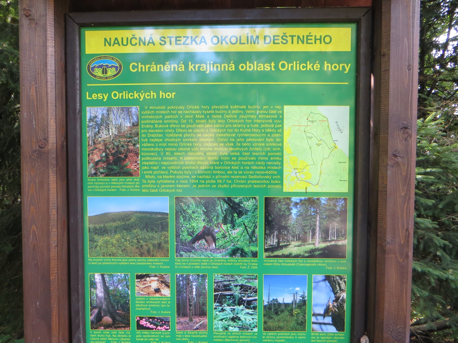
There were plenty of information boards too. A few had an English or German translation, but not this one:
By 3.00pm local time I had reached my 4th ten point summit of the day. This was the 1084m high Vrchmezi reference OK/KR-010, on the Czech - Polish border where there is a three sided marble mounument to famous people and a wooden shelter with table and chairs inside and a large mapboard. Superb facilities and a monument to admire that the Czech authorities should be proud of.


Thirty contacts were logged in Morse and Voice before I set off back towards my hotel lodge, which is within the activation zone for KR-069 Serlich, my final summit activation of the day. The ridge must catch the snow in the winter - most of the ski runs in the area go down into Poland. I came across some chair lifts prior to finding the trig point for KR-069:


My 5th activation of the day was finished by 5.30pm and I made my way to Masarykova Chata to check in and enjoy some regional food. It had all gone very well indeed.
Statistics
- Distance walked / ascent: 7.8 miles / 1300 feet
- Summits activated (5): OK/KR-064-061-068-010-069
- Equipment used: Yaesu FT-817 (5 watts) link dipole 2m FM monitored - no contacts there
- Points claimed: 50
- SOTA Complete: 5/5
- QSOs made on 20m CW/SSB & 30m CW bands: 126
- Summit to Summit contacts: 7
- Log to Map of the days contacts (thanks ON6ZQ)
More Czech Republic reports to follow... when I find the time to write
No comments:
Post a Comment